Three scenario planning workshops a success in Antananarivo
By Rui Han, PhD student
Department of Environment and Geography, University of York
October 2023
From September 19th to 26th 2023, over eighty stakeholders came together of three, three-day three participatory scenario workshops to discuss perceptions of changes in climate, land use, heatwaves, and proximity to greenspace in Madagascar’s capital, Antananarivo. A team of researchers from the FLOURISH research programme brought together local municipalities Amonhitrimajka, Bemasoandro, and Ambohimanambola, the University of Antananarivo, and the Madagascar Forests and Communities Caretakers Association.
We focused on the complex challenge of how declining vegetation is exacerbating climate extremes -specifically the urban heat island effect. Antananarivo, historically called Analamanga (meaning ‘blue forest’), transformed from the hilltop of Analamanga hill in the nineteenth-century to a metropolis of over two million inhabitants today, presenting a growing challenge for its urban population. Today, there variations across neighbourhoods in land surface temperature is notable, sometimes exceeding 10°C across settlements and more than 2°C across districts. Particularly, 78% of city settlements had greenspace access below 50%, and 58% had less than 25% coverage access within their neighbourhood environments (500 by 500 meters). Raising temperature and uneven distribution of greenery are growing concerns in cities like Antananarivo, where rapid population growth and unplanned urbanization are exacerbating the effects of climate change.

A view of Antananarivo, Madagascar, showing that green infrastructure coverage extends from Analamanga Hilltop down to the base of Antananarivo.
During the workshops, participants carried a participatory scenario planning activity to develop potential future scenarios for each municipality. Key vectors of uncertainty stemming from drivers of land-use change were identified as: (i) Long-term urban planning and infrastructure modernisation vs. overcrowded slums and declining service access, and (ii) Ecosystem restoration and conservation with sustainable awareness vs. ecosystem degradation and land exploitation without governance accountability.
From these vectors, participants developed four plausible, diverse scenarios. Each scenario assessed how changes in population growth, infrastructure development, and land-use transitions might impact greenspace access and city’s heat profile. These were creatively entitled: Loveable future (S1), Development prioritised over environment (S2), Worst tomorrow (S3), and Runaway development (S4). Participants anticipated that under sustainable scenarios like S1, green infrastructure such as urban parks, green roofs, and tree-lined streets could be effective solutions to mitigate surface temperature and improve wellbeing, whereas unsustainable scenarios like S3 could lead to intensified heatwaves.
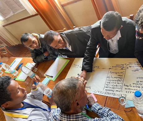
Engaged stakeholders documenting historical events in Ambohimanambola
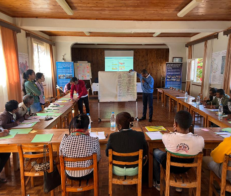
Research assistant Patrick Laby presenting four developed future scenarios in Ambohimanambola
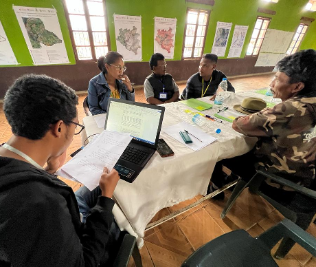
Group discussion focused on a specific scenario in Amonhitrimajaka
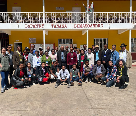
Group photo taken during the workshop in Bemasoandro
During the roundtable discussions, interesting remarks were made. For example, residents from the municipality of Bemasoandro observed that ‘‘high population density and limited green cover exacerbate the heat and drought.’’ In contrast, in Ambohimanambola, which is higher in elevation and has more vegetation cover, residents mentioned that they experience less intense heat. A participant noted, ‘‘Higher temperatures are significantly felt when traveling from Ambohimanambola to the city centre.’’ In Amohitrimajaka, a basin for rice and crop cultivation, residents expressed a desire for tree-planting initiatives and greenspace maintenance, viewing these efforts as essential for improving living conditions and reducing health risks.
At the close of the workshop, many participants remarked, ‘‘This is the first green infrastructure workshop proposed at the municipal level.’’ Some participants added, ‘‘These outputs will serve as a powerful model for responding to short-term shocks and long-term environmental challenges at both local to national levels in Madagascar.’’
The application of the method of scenario planning is particularly novel in Madagascar; none of the participants had been involved in such a process before. The next step is to now use these results to translate narrative scenarios into spatially explicit outputs. We hope these interactions will be the start of long-lasting collaborations in Antananarivo.