Our lab attends CropWatch Cloud workshop in Madagascar using Earth observation for crop monitoring
By Daulphin Razafipahatelo, PhD student
Essa Forets, University of Madagascar
November 2024
Addressing agricultural challenges with Earth Observation
Many farmers in Madagascar rely on traditional methods for farming with limited access to modern monitoring tools, making it difficult to predict crop stress and extreme events, manage resources effectively, and ensure stable yields. A significant portion of the population is vulnerable to fluctuations in food prices and environmental impacts, which disrupt agricultural production and increase food insecurity. In this context, digital tools that integrate Earth Observation and ground data can help improve agricultural yield and environmental resource management. The CropWatch Cloud platform provides such a solution by enabling real-time monitoring of crop conditions and production trends. To strengthen capacity in this field, a workshop was held in Madagascar, bringing together researchers, policymakers, and field practitioners to explore the application of Earth Observation in agriculture.
CropWatch Cloud Training: Enhancing digital agriculture skills
From November 5th to 8th, 2024, PhD student Daulphin Razafipahatelo attended a workshop on CropWatch Cloud, an advanced platform for crop monitoring based on Earth Observation. For four days in Ambodivoina Antananarivo, Daulphin was immersed in learning new techniques and tools that enhance our understanding of crop health and growth patterns, a vital skill for supporting sustainable agriculture.
The training was structured into two days of theoretical background, and two days of practical components:
- Days 1-2: Theoretical sessions on CropWatch Cloud, the Ground Verification Group (GVG) mobile application, and digital agriculture techniques. Discussions focused on how Earth Observation can enhance food security by providing timely insights into crop health, stress factors, and yield estimation.
- Days 3-4: Field visits to rice and maize fields in the Analamanga and Itasy regions. Participants engaged in data collection exercises using GVG, comparing remote sensing data with on-the-ground observations. This hands-on training helped bridge the gap between Earth Observation data and practical agricultural decision-making.
The training workshop was organised by the Ministry of Agriculture and Livestock in collaboration with the World Bank through Digital Agriculture, Data and Innovation, along with the CropWatch project team from the Aerospace Information Research Institute of the Chinese Academy of Sciences.
Applications
The CropWatch Cloud platform offers significant applications for agriculture in Madagascar, including
- Early warning systems by providing timely alerts on droughts, floods, and other stress factors impacting crops);
- Yield prediction models byimproving forecasting accuracy by integrating Earth Observation and ground data);
- Precision agriculture by helping farmers make informed decisions on irrigation, fertilisation, and pest control based on real-time data); and
- Policy support by enabling governments and organizations to design targeted interventions to improve food security.
Field experience: Learning by doing
One of the most exciting parts of this training was the in-field session, where participants learned hands-on data collection methods. This practical experience highlighted the importance of combining satellite-based Earth Observation insights with field observations to improve the accuracy of crop monitoring models, ultimately helping us make better-informed decisions for agriculture. Participants visited rice fields surrounding Antananarivo, and Analavory, Itasy, where they conducted direct assessments of crop health, soil conditions, and yield potential. Using the GVG application, we learned how to collect and validate data on crop type, phenological stages, and stress indicators. The hands-on training also demonstrated how smallholder farmers could benefit from these technologies, particularly in regions vulnerable to climatic shocks.
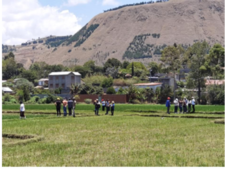
Participants discussing how Earth Observation tools can be when paired with ground data for sustainable crop management
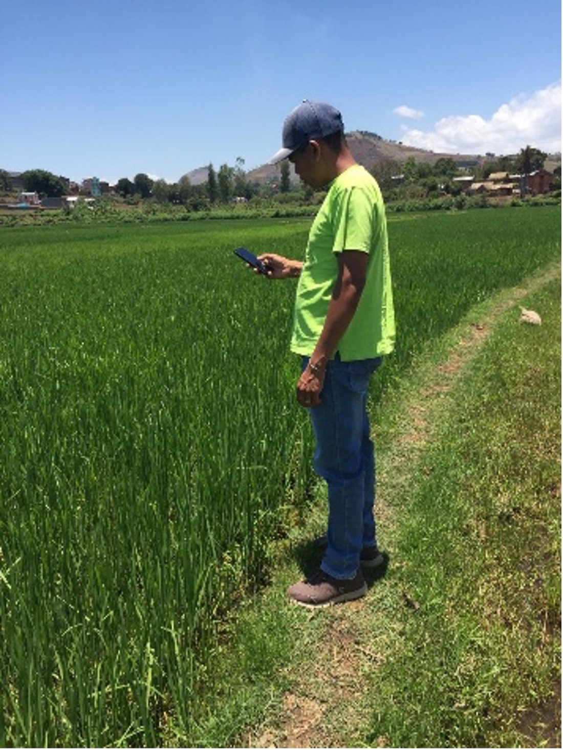
PhD student Daulphin Razafipahatelo collecting data (GPS location, crop type, crop height, photes) on GVG mobile application from his smartphone
Future prospects
Looking ahead, collaboration between researchers, government institutions, and development partners is key to scaling these applications. This workshop reinforced the potential of Earth Observation in strengthening food security strategies. By equipping participants with knowledge and tools for advanced crop monitoring, it laid the foundation for more data-driven and resilient agricultural practices in Madagascar. Future efforts should focus on training more local stakeholders, refining -based models with extensive ground truth data, and integrating CropWatch Cloud insights into national agricultural policies.
As a representative of my institution, I look forward to integrating these learnings into future research and field projects. Continued engagement with CropWatch Cloud will be essential in supporting sustainable agriculture and ensuring that Earth Observation technologies are leveraged to benefit local communities.

Field trip to rice and maize agricultural land in and around Antananarivo which covered up to 50% of the capital
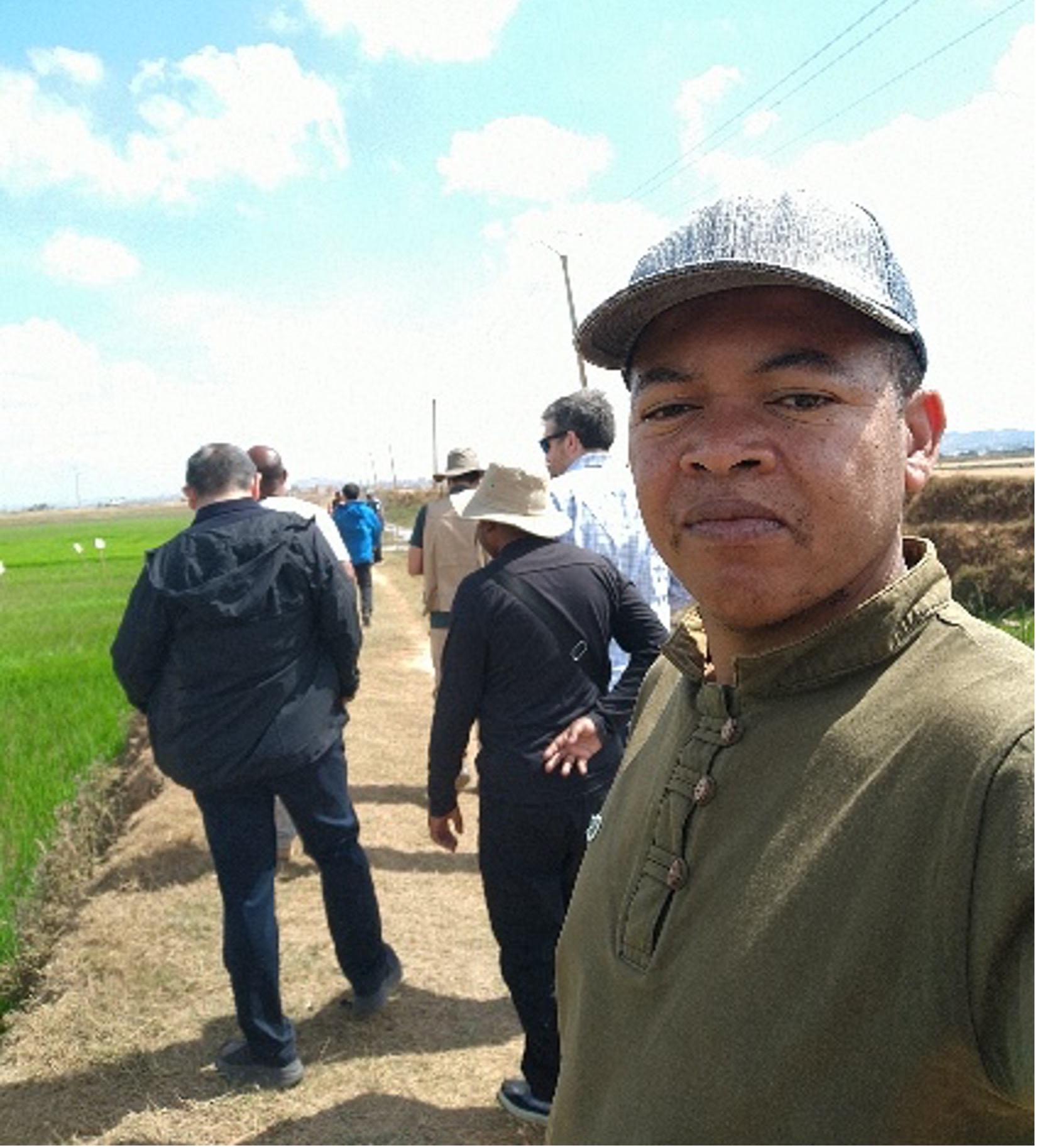
PhD student Daulphin Razafipahatelo during the fieldtrip
Acknowledgments
Daulphin would like to thank the Centre for Geoinformatics Applications for Rural Development, Madagascar’s Ministry of Agriculture and Livestock, the Aerospace Information Research Institute of the Chinese Academy of Sciences, the CropWatch team, and the World Bank for organizing and supporting this valuable workshop.